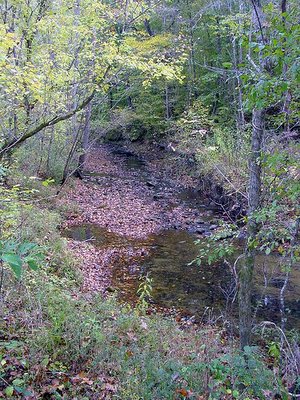
All the water on our place drains into a creek that runs through the property. We had a very dry fall, but the creek still flowed, at least a little.
Once it started raining again, it rained more than usual, and as a result the weathermen say we're back up to "normal" for the year. (Somewhere around 55 inches or 140 cm.)
Here's the creek yesterday, after several inches of rain the day before:
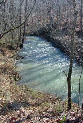
By today it'll probably be back somewhere between those two extremes.
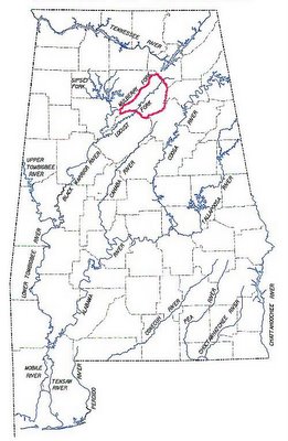
Here's the big picture, showing all the major rivers in Alabama: I've somewhat shakily outlined our county in red. You can click on any of these for a larger view.
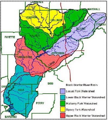
Here it is with only the Black Warrior River shown, including all its forks, tributaries and feeders. Most of the water in Blount County eventually drains into the Black Warrior. (Exceptions here.)
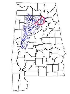
It's the Locust Fork that's our watershed. There are supposed to be 15 sub-watersheds, but I haven't been able to find a list online. Our little creek drains into the Blackburn Fork (a Locust Fork tributary).
Locate your watershed
The bigger picture:
South Atlantic-Gulf watershed
The really big picture:
Regional watersheds
I found a watershed lookup for Canada too, but it doesn't seem to be working. If you know of any good links feel free to post them in the comments section.
Local links:
Alabama Rivers Alliance
Friends of the Locust Fork
Beautiful photography of the Locust Fork from The Kingfisher Editions by Beth Maynor Young
No comments:
Post a Comment